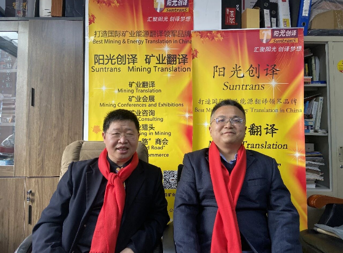
On February 5, 2026, Dr. Lv Guo from Suntrans co‑hosted a professional live‑stream session with Mr. Chen Zhen, an expert in AI‑driven ore prospecting via remote‑sensing geology. Focusing on core pain‑points plaguing mineral exploration — high costs, long cycles and low success rates of conventional prospecting — they conducted in‑depth analysis covering the core principles, technical highlights, application scenarios and practical value of AI‑powered remote‑sensing geology for ore hunting. From technical rationales and real‑world case studies to hands‑on implementation, they addressed key questions on technology selection and exploration deployment for mining enterprises. The discussion helps mining companies tackle challenges such as greenfield exploration overseas and surveys in harsh‑terrain regions, enabling precise ore targeting alongside cost reduction and efficiency gains.
Dr. Lv Guo (Suntrans): Hello, Mr. Chen. Today’s mineral‑exploration industry faces two major pain‑points: conventional prospecting incurs high costs and long lead‑times. Overseas greenfield exploration and work in harsh terrain are even more challenging. Low prospecting success rates and heavy investment risks trouble many mining enterprises. The advent of AI‑assisted remote‑sensing geology for ore prospecting has been hailed within the industry as a “prospecting revolution”. Today we will dive deep into its core principles, application scenarios and practical value to resolve critical questions for mining firms regarding technology selection.
I. Technical Fundamentals
What is the core principle behind satellite remote‑sensing for identifying ground‑object types and mineral compositions?Mr. Chen Zhen: The core mechanism lies in differences in electromagnetic‑spectral responses of surface features. Variations in material composition and texture of different ground objects produce distinct reflection, absorption and emission signatures across electromagnetic wavelengths, forming unique “spectral fingerprints”. Satellite sensors capture such spectral information. By analyzing characteristic peaks and absorption troughs on spectral curves, surface‑object categories and mineral constituents can be correspondingly identified.
What are the key distinctions between multispectral remote sensing and hyperspectral remote sensing?Mr. Chen Zhen: The primary differences lie in spectral resolution and band quantity. ‑ Multispectral remote sensing: small number of bands (typically 3‑10), low spectral resolution; mainly distinguishes broad surface‑object classes such as vegetation, rock and water bodies. ‑ Hyperspectral remote sensing: hundreds of available bands with extremely high spectral resolution. It captures subtle spectral differences of ground materials and enables direct identification of specific mineral constituents (e.g. hematite, kaolinite). It serves as a core technology for mineral mapping and mineralized‑alteration detection.
What is the principle of the Spectral Angle Mapper (SAM) algorithm for mineral identification and mineral mapping?Mr. Chen Zhen: Spectral Angle Mapper (SAM) calculates angular similarity among spectral vectors. Treating each image‑pixel spectrum as a vector in high‑dimensional space, the algorithm computes angles between pixel‑level spectra and reference spectra of known standard minerals. Smaller angles indicate higher spectral similarity, marking the pixel as corresponding to the target mineral. Pixel‑by‑pixel matching generates regional mineral‑distribution maps.
What underlies the core principle of patents related to AI‑based remote‑sensing‑geology ore prospecting?Mr. Chen Zhen: Our patents center on topological‑relationship analysis for multi‑source geological layers and an automatic anomaly‑intersection algorithm. AI automatically extracts layers including lithostructural features, mineral assemblages and geochemical anomalies. Based on topological principles, spatial correlations between layers (e.g. superposition of structural buffer zones and mineral anomalies) are evaluated. Mineralized target areas are automatically delineated, mitigating low efficiency and heavy subjectivity associated with traditional manual interpretation.
What core technical support can be delivered by invention patents and software copyrights held by Mr. Chen Zhen of the Suntrans team?Mr. Chen Zhen: Patents and software copyrights deliver three categories of support: ‑ Automated interpretation support: AI‑driven automatic extraction of lithology, structures and mineral alteration to replace conventional visual interpretation. ‑ Intelligent target‑area delineation support: multi‑layer anomaly‑intersection algorithms automatically generate precise prospecting targets and extract coordinate datasets. ‑ Mineral‑prospectivity prediction support: trained on typical metallogenic models, AI performs global‑scale metallogenic‑potential forecasting and guides overseas exploration work.
Compared with conventional prospecting workflows, what are the core technical strengths of this AI‑powered remote‑sensing‑geology prospecting technology?Mr. Chen Zhen: Its strengths can be summarized as fast, extensive, precise and cost‑effective. ‑ Fast: regional target‑area delineation finished within roughly ten days, replacing months‑long field surveys. ‑ Extensive: global coverage unrestricted by terrain or national boundaries; works for high‑altitude zones, deserts and other inaccessible regions. ‑ Precise: cross‑validation of multi‑source datasets plus iterative AI algorithms markedly improve target‑area accuracy. ‑ Cost‑effective: field‑exploration and geophysical‑survey expenditures drop substantially, yielding superior input‑output ratios.
What key steps constitute remote‑sensing‑data preprocessing?Mr. Chen Zhen: Four major categories of correction and optimization are performed: ‑ Atmospheric correction: eliminates atmospheric absorption and scattering to restore true surface‑object spectra. ‑ Geometric correction: removes image distortions caused by satellite attitude and terrain undulation for accurate geographic registration. ‑ Radiometric correction: compensates for sensor‑response discrepancies and uneven illumination to preserve authentic radiometric information. ‑ Noise and color correction: suppress image noise and unify color schemes for improved interpretability.
What types of datasets are integrated in multi‑source remote‑sensing data fusion?Mr. Chen Zhen: Fusion falls into broad‑sense and narrow‑sense categories. ‑ Broad‑sense fusion: integration of remote‑sensing imagery with non‑remote‑sensing datasets such as geochemical‑exploration data, geophysical‑prospecting data and field‑measured geological records. ‑ Narrow‑sense fusion: merging different remote‑sensing images. Representative combinations include “multispectral + panchromatic imagery” to reconcile high spatial resolution and high spectral resolution; and “optical remote sensing + microwave remote sensing” to resolve data gaps caused by rainy and cloudy weather.
In visual lithostructural interpretation, what tonal and textural differences distinguish granite and limestone on remote‑sensing imagery?Mr. Chen Zhen: Distinctions are pronounced. ‑ Granite: SiO₂ content exceeds 65 %, showing pale gray‑white tones. Magma had low fluidity, forming mostly rounded rock masses. Physical weathering produces radial fractures, often yielding wheel‑pattern drainage systems (combination of radial and annular drainage patterns). ‑ Limestone: carbonate rock exhibiting medium‑gray tones. It readily undergoes dissolution to form karst landforms (peak forests, grikes). Drainage networks are mostly dendritic, and vegetation coverage is higher than over granite units.
What are the core procedural steps for delineating prospective mineralized targets using AI‑driven remote‑sensing‑geology prospecting technology?Mr. Chen Zhen: The workflow hinges on “multi‑layer superposition plus AI‑detected anomaly intersection”, with four steps: ‑ Lithostructural‑layer superposition: AI automatically interprets lithology and structures to map spatial distribution of ore‑controlling geological bodies. ‑ Mineral‑mapping‑layer superposition: hyperspectral techniques extract diagnostic mineral assemblages to pin down mineralized‑alteration zones. ‑ Geochemical‑anomaly‑layer superposition: overlay ion anomalies (e.g. iron, hydroxyl ions) correlated with metallogenic factors. ‑ Mineralization‑index‑layer superposition: construct targeted mineralization indices to quantify metallogenic potential. Finally, AI algorithms identify spatial intersections of multi‑layer anomalies and automatically extract coordinates and boundaries of prospecting targets.
What is the core function of 3D mine modeling? What base datasets are required to build a 3D geological model?Mr. Chen Zhen: ‑ Core function: convert complex geological bodies / orebodies into 3D digital models for accurate resource‑volume calculation, mining‑engineering guidance and mineral‑right administration support. It constitutes a critical link bridging exploration and mine development. ‑ Required base datasets: five groups: field‑measured geological data (drill‑hole records, geological maps), geophysical‑prospecting / geochemical‑exploration data, remote‑sensing interpretation results, engineering logging records, and geospatial datasets (DEM, coordinate parameters).
Are there technical barriers or licensing restrictions when deploying the patented methods in real‑world projects? What cooperation models are available?Mr. Chen Zhen: Our patents are commercially deployed with no core technical barriers and flexible licensing arrangements. Major cooperation modes include: ‑ Project‑based cooperation: deliver technical services for designated exploration projects. ‑ Technology licensing: grant enterprises usage rights for patented algorithms and software. ‑ Joint development: customize technical solutions for specific mineral commodities or regions.
How can misjudgment rates be lowered for metallogenic‑prediction work in geologically complex settings?Mr. Chen Zhen: The core approach is “multi‑source validation constrained by geological rules”. ‑ Adhere to the principle: “no anomaly, no mineralization; no geological variation, no mineralization”. Prioritize zones marked by sharp geological transitions. ‑ Cross‑validate remote‑sensing, geophysical and geochemical datasets to filter spurious anomalies from single‑source data. ‑ Apply mineral‑assemblage and metallogenic‑mechanism constraints; only accept anomalies consistent with metallogenic rules. ‑ Emphasize structural ore‑control; prioritize anomalies within structural buffer zones and contact zones.
How well do prospecting targets derived from remote‑sensing prospecting correlate with actual drilling results?Mr. Chen Zhen: Matching rates depend heavily on mineral type and outcrop conditions. ‑ Placer deposits and supergene deposits: well‑exposed surface outcrops yield matching rates above 90 %. ‑ Hypogene deposits with surface outcrops: matching rates exceed 50 %. ‑ Concealed deposits: indications are indirect and rely on metallogenic models; matching rates are comparatively lower yet can be substantially improved via multi‑source data fusion.
What disruptive transformations will the integration of high‑resolution remote‑sensing datasets and AI bring to mineral‑exploration in the future?Mr. Chen Zhen: Four major shifts are anticipated: ‑ Global‑reach exploration: satellite datasets accessible worldwide remove geographic constraints for near‑ubiquitous prospecting coverage. ‑ Widespread automated interpretation: AI replaces manual labour and boosts interpretation efficiency manifold. ‑ Intelligent metallogenic prediction: models trained on global samples deliver precise global‑scale prospectivity forecasting. ‑ Greatly shortened exploration cycles: outcomes generated in roughly ten days instead of multi‑month campaigns, achieving substantial cost‑and‑time savings.
II. Case Studies
What are the key application scenarios for AI‑powered remote‑sensing‑geology ore‑prospecting technology, and what economic benefits can mining enterprises obtain?Mr. Chen Zhen: Primary scenarios focus on early‑stage exploration and geographically challenging regions: ‑ Greenfield mine exploration: rapid delineation of prospecting targets to support mineral‑right acquisition decisions. ‑ Mineral‑right evaluation and decision‑making: assessment reports produced within roughly ten days to back investment judgements. ‑ Remote‑area exploration: screen prospective ore occurrences across inaccessible zones such as high‑altitude and desert terrain. ‑ Regional metallogenic forecasting: guide regional geological surveys and delineate metallogenic belts. Economic value manifests in three dimensions: faster decision‑making with mitigated risks, higher efficiency and lower costs, and capturing early‑mover advantages for overseas‑resource acquisition.
What types of harsh‑exploration‑condition regions are best suited for this technology?Mr. Chen Zhen: It performs best in harsh regions with surface outcrops, including deserts, gobi deserts, high‑altitude bare‑rock zones and peripheries of snow‑capped mountains. It is especially applicable to overseas territories such as Africa and the Middle East featuring sparse baseline geological information and abundant supergene deposits.
What interferences affect remote‑sensing‑data acquisition in high‑altitude zones and primeval‑forest‑covered complex terrain? How are these challenges addressed?Mr. Chen Zhen: ‑ High‑altitude regions: disturbances stem mainly from cloud cover and snow‑ice. Microwave remote sensing penetrates cloud layers; multi‑temporal data fusion mitigates snow‑ice interferences. ‑ Primeval‑forest zones: vegetation obscures surface outcrops. Hyperspectral vegetation‑penetration algorithms and SAR datasets extract terrain and structural features for indirect identification of mineralization signals.
What application advantages does this technology offer in geologically data‑sparse regions such as Africa and the Middle East?Mr. Chen Zhen: Advantages are prominent. ‑ Comprehensive data coverage: publicly available global remote‑sensing datasets eliminate reliance on scarce local geological archives. ‑ Superior efficiency‑cost profile: regional exploration completed in roughly ten days at merely 1/5‑1/10 of conventional‑method costs. ‑ Accurate target identification: multi‑source‑data fusion compensates for inadequate local geological documentation, yielding target‑area matching rates superior to traditional workflows.
For “near‑mine expansion exploration” in mature mining districts, what practical exploration bottlenecks can this technology resolve?Mr. Chen Zhen: Three key challenges are addressed: ‑ Concealed‑ore identification: indirect inference of deep concealed deposits via surface‑alteration and structural correlations. ‑ Tracing ore‑belt extensions: AI automatically identifies propagation trends of structures and alteration zones to delineate peripheral prospecting targets. ‑ Resource‑volume updating: 3D modelling enables dynamic, accurate ore‑resource calculation supporting expansion‑target exploration.
For directly mineable supergene deposits (e.g. placer deposits), how does this technology precisely delimit mineable extents?Mr. Chen Zhen: Implementation relies on “hyperspectral mineral identification plus multi‑temporal dynamic monitoring”. ‑ Hyperspectral analysis accurately identifies mineral constituents and grade distribution of placer deposits. ‑ Multi‑temporal‑data fusion analyses spatial distribution and dynamic variation of placer accumulations. High‑grade mineable placer boundaries are finally delineated to guide mining planning.
How adaptable is this technology for metallic‑mineral exploration? Can it cover prospecting requirements for mainstream mineral commodities?Mr. Chen Zhen: Adaptability is high. It supports exploration for major metals including gold, copper, iron, lead‑zinc and nickel. Distinctive alteration‑mineral assemblages correspond to different commodities (e.g. pyrite associated with gold, hematite with iron). Combined with structural ore‑control rules, precise prospecting can be realized.
In geologically data‑deficient regions, how does the technology fill data gaps and guarantee prospecting reliability?Mr. Chen Zhen: The core strategy is “multi‑source‑data fusion plus metallogenic‑model analogy”. ‑ Integrate remote‑sensing datasets with publicly available geophysical‑prospecting / geochemical‑exploration data to offset local‑data shortages. ‑ Draw analogies between geological features of the study area and metallogenic models of typical global deposits to infer ore‑forming potential. ‑ AI algorithms automatically extract anomalies and reduce dependence on subjective human expertise.
Can this technology perform indirect prospecting for deeply buried deposits? What is its core technical workflow?Mr. Chen Zhen: Indirect prospecting is feasible. The core logic follows “surface alteration ‑ structural association ‑ metallogenic‑model analogy”. ‑ Identify spatial correlations between surface mineralized‑alteration zones and ore‑controlling structures. ‑ Apply metallogenic‑depth models of typical deposits to analogically predict deep‑mineralization potential. ‑ Compute metallogenic probability via mathematical‑geology methods and delineate deep prospecting targets.
What auxiliary value can integrated mine‑environmental‑monitoring and prospecting work derive from this technology?Mr. Chen Zhen: Integrated “prospecting plus monitoring” workflows are enabled. ‑ Track dynamic shifts in mineralized alteration around mines to support prospecting activities. ‑ Detect geological‑hazard precursors such as landslides and collapses to safeguard exploration safety. ‑ Monitor environmental impacts from tailings ponds and waste‑rock dumps and support green‑mine development.
How are remote‑sensing‑data stability and interpretation accuracy guaranteed in climatically complex zones (high‑temperature, heavy‑rainfall, intense sand‑storm conditions)?Mr. Chen Zhen: Guarantees are delivered by “multi‑source‑data complementarity plus AI‑algorithm optimization”. ‑ High‑temperature and heavy‑rainfall zones: microwave remote sensing penetrates cloud‑rain, supplemented by multi‑temporal fusion of optical imagery. ‑ Sand‑storm‑prone zones: SAR datasets extract terrain and structural features; hyperspectral datasets identify mineral signatures. ‑ AI algorithms automatically correct spectral distortions caused by climatic factors to improve interpretation fidelity.
What application differences exist between small‑occurrence prospecting and contiguous large‑mining‑district exploration?Mr. Chen Zhen: ‑ Small mineral occurrences: emphasis on precise identification; hyperspectral and AI tools rapidly pinpoint mineralized sites and delimit mineable boundaries. ‑ Large mining districts: emphasis on macro‑scale overview; multi‑source‑data fusion delineates metallogenic belts to guide contiguous‑area exploration and resource‑volume estimation.
How can the technology identify associations between concealed structures and mineralized zones and improve prospecting efficiency?Mr. Chen Zhen: Core workflow: “SAR‑derived structural extraction + hyperspectral alteration identification + AI correlation analysis”. ‑ SAR data penetrate vegetation / overburden to extract concealed faults, folds and other structures. ‑ Hyperspectral remote sensing maps surface alteration zones. ‑ AI algorithms automatically analyse spatial correlations between structures and alteration zones to delineate high‑prospectivity areas.
Is offline operation or lightweight on‑site data processing feasible in remote zones without communication coverage?Mr. Chen Zhen: Yes. Our software supports offline preprocessing and AI‑driven interpretation. Portable field‑deployed hardware executes lightweight processing on‑site; deep‑dive analysis and target‑area generation can be completed after returning to network‑available locations.
What prospecting‑success rates have been achieved under complex geological conditions in past projects? Are there representative case records?Mr. Chen Zhen: For complex regions with surface outcrops, prospecting success rates exceed 60 %. As a typical example, three targets delineated for an African gold‑exploration project using AI‑enhanced remote‑sensing were all intersected by drilling, with peak grades reaching 12 g/t. For a domestic iron‑ore project, drilling‑validation matching rates for delineated targets hit 85 %.
III. Implementation & Practical Deployment
What is the standard turnaround time for completing a prospecting report and target‑area delineation using this technology?Mr. Chen Zhen: Standard lead‑time ranges from 15‑30 days, subject to regional extent and data‑acquisition difficulty. Areas within 100 km² take roughly 15 days; areas above 1000 km² take approximately 30 days.
When combined with conventional drilling and geophysical‑prospecting techniques, how should work‑phases be arranged to achieve optimal cost‑efficiency?Mr. Chen Zhen: A three‑phase integrated approach is recommended: ‑ Early phase: rapid target‑area delineation via AI‑enhanced remote‑sensing (accounts for 10 % of total costs). ‑ Intermediate phase: detailed geophysical surveys focused on pre‑selected targets (30 % of total costs). ‑ Late phase: drill‑hole validation for geophysically detected anomalies (60 % of total costs). This workflow cuts traditional exploration expenditures by 30‑50 %.
What specific resource‑evaluation outputs can this technology deliver during pre‑transaction mineral‑right assessment?Mr. Chen Zhen: Five categories of information are provided: target‑area coordinates, metallogenic‑probability metrics, resource‑volume estimates, mineralization‑type classification and ore‑controlling‑factor analysis. A complete mineral‑right‑evaluation report is generated to underpin transaction‑related decision‑making.
Can target‑area outputs serve as core decision‑making inputs for mineral‑right application and mineral‑right transactions?Mr. Chen Zhen: Yes. Target‑area datasets are generated via multi‑source‑data fusion and AI algorithms and have demonstrated high validation‑matching rates in field projects. Multiple mining enterprises have adopted these outputs as core decision‑making references for mineral‑right applications and transactions; portions of deliverables have passed filing reviews by land‑and‑resources authorities.
How does the technology support scoring within comprehensive mineral‑right‑evaluation frameworks?Mr. Chen Zhen: Quantitative inputs feed scoring for dimensions including metallogenic potential, resource magnitude and exploration risk: ‑ Metallogenic potential: scoring based on mineralization indices and mineral assemblages. ‑ Resource magnitude: scoring derived from 3D‑model‑based estimation outputs. ‑ Exploration risk: scoring grounded in geological‑setting conditions and anomaly robustness.
What hardware, software and technical personnel are required for enterprises adopting this technology?Mr. Chen Zhen: ‑ Hardware: high‑performance workstations for AI computation; portable devices supporting on‑site offline processing. ‑ Software: our patented algorithm software plus remote‑sensing‑processing platforms (e.g. ENVI, ArcGIS). ‑ Personnel: one‑to‑two technical staff with foundational background in remote‑sensing geology and AI algorithms; operational competence can be built via training.
What are ongoing‑operation‑and‑maintenance costs? Are continuous technical‑updates and personnel training required?Mr. Chen Zhen: Post‑deployment O&M costs are moderate. Major expenses include annual software upgrades (roughly 10 000‑20 000 CNY) and semi‑annual personnel training sessions. We iteratively upgrade algorithms and software and provide cooperating enterprises with free technical updates and remote support.
Do outputs satisfy regulatory requirements for mineral‑exploration filing and mineral‑right approval procedures?Mr. Chen Zhenzen: Fully compliant. Our deliverables strictly follow national standards such as Specifications for Mineral‑Resource Exploration and Specifications for Remote‑Sensing Geological Interpretation. Target‑area datasets and resource‑volume estimates are directly admissible for exploration filing and mineral‑right‑approval workflows.
Can this technology rapidly adapt to existing enterprise exploration workflows for seamless integration?Mr. Chen Zhen: Yes. It deeply integrates with existing exploration pipelines: it substitutes for conventional regional geological surveys in early‑stage work, optimizes geophysical‑prospecting targets in intermediate‑stage work and supports drill‑hole validation in later‑stage work. No full workflow restructuring is required; adaptation can be completed within one‑to‑two weeks.
How is data security guaranteed? Can compliance risks for remote‑sensing‑data usage be avoided?Mr. Chen Zhen: For data security: dual safeguards apply including local encrypted storage plus cloud‑based permission access control. For compliance: only publicly available, legally licensed remote‑sensing datasets (e.g. Landsat, Sentinel series) are used, in full observance of national data‑security and remote‑sensing‑data‑usage regulations, eliminating compliance hazards.
What technical support and after‑sale services are available for adopting enterprises?Mr. Chen Zhen: Full‑lifecycle technical support is provided: ‑ Pre‑project: custom project‑scheme formulation and personnel training. ‑ Mid‑project: remote technical guidance and data‑processing support. ‑ Post‑project: deliverable‑report review, algorithm iteration‑upgrades and post‑project review optimization.
What input‑output ratios can be expected? How much exploration‑cost reduction can be achieved compared with conventional prospecting modes?Mr. Chen Zhen: Input‑output ratios reach 1:5‑1:10. Exploration‑cost reductions of 30‑60 % versus traditional prospecting workflows are realized, mainly via savings on field surveys and optimized geophysical‑survey coverage.
What core support is provided for mineral‑right‑renewal and expansion‑target exploration?Mr. Chen Zhen: ‑ Mineral‑right renewal: deliver resource‑volume updates and metallogenic‑potential‑assessment reports to support renewal applications. ‑ Expansion‑target exploration: delineate peripheral metallogenic belts and generate expansion‑prospecting targets to furnish evidence for expansion‑related applications.
Is custom‑tailored development available to match enterprise‑specific mineral‑commodity and regional‑exploration demands?Mr. Chen Zhen: Custom‑tailored development is supported. Algorithms and models can be optimized for specific commodities (e.g. lithium, rare‑earth elements) or special regions (e.g. tropical rain‑forest, polar zones) to build dedicated prospecting solutions.
Can overall timelines for mineral‑right finalization and mine development be shortened after deploying this technology?Mr. Chen Zhenzen: Substantial timeline compression is achievable. Conventional mineral‑right‑finalization cycles of 6‑12 months can be shortened to 3‑6 months; mine‑development cycles can be reduced by 1‑2 years. Improvements stem from enhanced target‑area accuracy, accelerated exploration workflows and drastically reduced drill‑hole‑validation time and costs.
Dr. Lv Guo (Suntrans): Thank you very much for this comprehensive presentation, Mr. Chen. Today we systematically reviewed core points of AI‑driven remote‑sensing‑geology ore‑prospecting technology, covering technical principles, scenario adaptability and hands‑on implementation. Professional, actionable answers were provided regarding disruptive technical strengths, solutions for complex‑scenario challenges, plus cost‑efficiency and compliance concerns that matter most to enterprises. This technology not only addresses long‑standing prospecting pain‑points but also delivers precise decision‑support for mineral‑right transactions, overseas‑resource deployment and expansion‑target exploration for mining enterprises, genuinely realizing “cost‑and‑time reduction with precise ore targeting”.
If mining enterprises hold exploration requirements for specific mineral commodities or regions, or wish to learn more about custom‑technology development and project‑cooperation details, the Suntrans team can provide one‑on‑one technical‑solution consultation and implementation support, helping enterprises seize opportunities and mitigate risks in mineral‑exploration endeavours. Thanks again to Mr. Chen Zhen for his valuable sharing!
← Back